Met Éireann issue two Status Orange warnings as Storm Brian approaches
Storm Brian officially named by Met Eireann and Met OfficeTwo Status Orange and three Status Yellow warnings declaredThe worst may not be over yet for the south of the countryUp to 60mm of rain is expected over next 24 hours alone in south of country
Met Eireann have issued two Status Orange warnings and three Status Yellow warnings as Storm Brian is offically named by Met Eireann.
The Ophelia-battered southern half of the country is now bracing itself for yet more high winds, along with potential torrential rainfall and spot flooding. It is estimated that 60mm of rainfall will fall in the south over the next 24 hours alone.
One of the Orange warnings is for the hard-hit counties of Wexford, Clare, Cork, Kerry and Waterford.
They can expect gusts of between 110kph and 130kph during a 12-hour period from midnight on Friday night until 12pm on Saturday.
Those powerful winds will come with risks of coastal flooding thanks to impending Storm Brian's arrival across central and eastern parts of the country late on Friday.
The other Orange warning is for counties Galway and Mayo.
They too can expect gusts of between 110kph and 130 kph, but that warning is in place from 6am Saturday until 6pm Saturday.
A Status Yellow wind warning has been issued for the entire country from 10pm Friday night for24 hours and mean wind speeds of 65kph will again batter Ireland, with gusts up to 110kph at times.
There is also a rainfall warning for Munster, Dublin, Carlow, Kildare, Kilkenny, Louth, Wexford, Wicklow and Meath where accumulations of 30 to 50mm that covers all day Thursday.
Finally, a Status Yellow weather advisory regarding the Atlantic depression now known as Storm Brian has been issued for the entire country with string winds gusting up to 110kph expected to hit for 36 hours from Frday at 6pm.
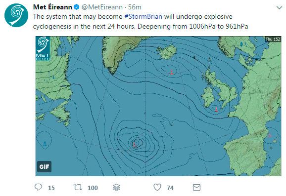
Tweeting this morning, Met Éireann wrote; "The system that may become #StormBrian will undergo explosive cyclogenesis in the next 24 hours. Deepening from 1006hPa to 961hPa."
Speaking to Independent.ie, a forecaster said that an "explosive cyclogenesis", which is otherwise known as a 'weather bomb' or 'explosive development', is a "rapidly deepening pressure system".
"We are now looking at the depression as it deepens and moves. It is predicted to move towards the south-west of Ireland tomorrow night and to move across the country.
"This will bring a risk of strong winds to the south of that," they added.
Chairman of the National Emergency Coordination Group Sean Hogan said they are not expecting anything like Ophelia's weather conditions.
"We don't have control of nature," Mr Hogan told RTE Radio One's Morning Ireland.
"Our job is to manage the consequences and the impact on society.
"Last weekend was an unprecedented event, we had no experience of hurricane conditions.
"We had good warning from Met Éireann and had time to calm and prepare.
"It enabled us to have a big impact.
"The ESB have restored about 312,000 customers, while Irish Water alone have restored more than 100,000.
"We don't know what the impact will be, I'd be much more confident [about the weather ahead]."
Mr Hogan added that the group's thoughts and sympathies were with the families of the Storm Ophelia fatalities.
Heavy overnight rainfall left many roads around Cork city and county suffering from spot-flooding.
Worst hit were roads in the Mayfield, Glanmire, Bishopstown and quays areas of the city.
The torrential rainfall and spot flooding resulted in traffic misery for commuters with lengthy delays along all routes into the city.
However, motorists were warned to expect surface water and spot-flooding in parts of Cork county as well including Bandon, Macroom, Fermoy, Mallow and Skibbereen.
The heaviest rainfall will be tonight with the greatest risk of flooding in Cork city between 9am and 6pm tomorrow.
Cork City Council officials are carefully monitoring rainfall levels amid fears that, in combination with a high tide, parts of the city quays could flood.
Gardaí have urged motorists to slow down and exercise extreme care given the challenging driving conditions.
However, the greatest fear is that the heavy rain and winds could bring down trees badly weakened by Hurricane Ophelia last Monday.
Cork took the brunt of the damage from Ophelia with more than 400 trees ripped down across the city and county.
A total of 35 giant Lime trees - planted to mark the opening of Henry Ford's car plant in Cork more than 100 years ago - were knocked over like dominoes on the Centre Park Road by the winds which reached 130km/h.
The other fear is that the heavy rainfall and gusting winds, albeit nowhere near as strong as Ophelia's last Monday, could also delay the work of emergency crews in restoring electricity and power to storm-hit households.
Join the Irish Independent WhatsApp channel
Stay up to date with all the latest news